Drone and urban planning
We have been involved in providing technical assistance for the urban planning of a development area.
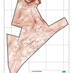
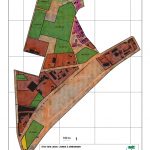
Thanks to the digital terrain model that we calculated from the data obtained by our drone, we were able to calculate a fine topography on the entire site. We thus transmitted to the customer :
- isohypse contour lines: 25 cm
- topographic profiles
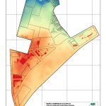
- the slope map
- Stormwater flow path map
-
- Modèle numérique de surface/Digital surface model
-
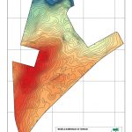
- Modèle numérique de terrain et courbes de niveau/Digital terrain model and contour lines
-
- Carte des pentes/Slope map
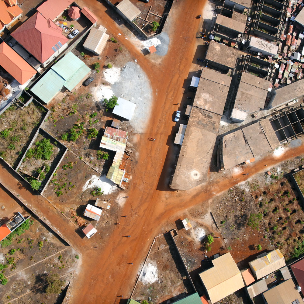
Thanks to the high resolution orthomosaic (5 cm/pixel), we have realized different inventories that will correspond to an initial state for the client.
-
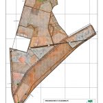
- Accessibilité et organisation/Accessibility and organization
-
- Zones à urbaniser/Zones to be urbanized
All the elements were transmitted in the form of files compatible with Geographic Information Systems.
For obvious reasons of confidentiality, the graticules of the cards have been erased.